View from cliffs above Maury Island Marine Area looking out over western Puget Sound down to the shoreline below

Week Without Driving 2026: Transit Trek with King County Parks

Join me and King County Parks on a Transit Trek to one of my favorite places, Maury Island Natural Area, Marine Park, and Dockton Forest on Thursday, October 1.

The outing takes place on the first day of the 2026 National Week Without Driving.

What: A Transit Trek Trip Audit

Maury Island is one of the best examples of a stunning local hiking and camping destination that is currently transit trekkable. Transit access has improved since we hiked this with Washington Trails Association in 2024 in the form of a more frequent weekday schedule for King County Metro route 119 and Water Taxi service. The water taxi now runs weekends, opening up much of Vashon’s pleasures to transit-reliant people. But the 119 continues to run only on weekdays, and is the only transit route serving Maury Island.

We’ll hike Dockton Forest and Maury Island Natural Area, with the option to extend the hike to Maury Island Marine Park. We’ll spend some time talking about current access to the area for nondrivers and what changes would increase and improve access. I’ll also review some of the other transit-accessible destinations on Vashon Island.

When: October 1, 2026

This is an all- or most-of-the-day outing. Check back for more details and to RSVP, including information for those starting from Tacoma using the Talequah Ferry.

How: Hiking boots on the ground and ORCA cards in hand

Check back to complete the RSVP form and get details about meeting up, preparing for the trip, and, if you want to, volunteering to help with the audit. You can see the audit volunteers helped put together at the Grand Forest hike on Bainbridge a couple years back at this link to get an idea of what we’ll produce.

Who: You

Info to help you decide if this is a trip you feel comfortable joining:

  • Attending is free, but participants are responsible for their own transit fare, lunch, and so on. Please note when RSVPing if you need assistance with fare; I’ll see what I can do.
  • I suggest that folks wear masks when we’re riding the bus together (about 25 minutes each way).
  • We’ll go rain or shine, but extreme weather or poor air quality may cancel.
  • Check back for details on estimated miles we’ll be hiking. There is only very mild elevation gain in the forest with overall elevation changes of 400 to 600 feet. Read a trip report here for more details.
  • Restroom access at Fauntleroy terminal, on the ferry, at Vashon Island Terminal, at Dockton Park, and some portapotty access during the hike.
  • Kiddos are welcome, but note the mileage and short but abrupt elevation changes on this hike. It’s probably best for older kids who can handle the mileage. That said, see the trip report above, which included a 6-year-old.
  • Dogs: Metro allows dogs on board at driver discretion, so most dogs may be able to make this trip. Dockton Forest and the marine area are both dog-friendly; leashes required. Ferry policy is here.
  • Service dogs are always permitted on transit.
  • These paths are generally not wheelchair friendly, though those who use some motorized mobility devices may find the forest trails reasonably navigable. The beach sections of the hike are generally not navigable for mobility devices.
  • For deaf or hard of hearing participants, please note your access needs in the RSVP form. While I don’t have the budget to hire an interpreter, I will do my best to work with you to find a good alternative. 
What to Bring
  • ORCA card or cash for fare
  • Dress for weather. We’ll go rain or shine, but extreme weather may cancel. 
  • A mask to wear on our two bus rides, which will be more crowded than usual
  • Snacks and water (water fountains at both ferry terminals, on the ferry, and at Dockton Park marina)
  • A sack lunch if you plan to eat on our quick lunch break during the hike
Handy Links
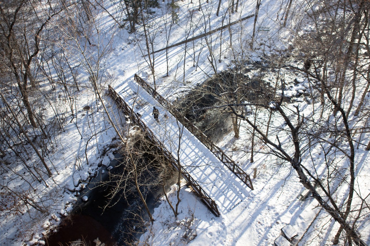
A snowy bridge over a creek in a snowy deciduous winter forest. POV is from overhead and a person and two small dogs cross the bridge.

Winter Transit Treks from Minneapolis

Featured image, above: Central Park, Bloomington, MN, courtesy H. Jiahong Pan

H. Jiahong Pan — former freelance journalist turned social work grad student — offers updates on last year’s recommended Winter transit treks from Minneapolis and offers two new itineraries for 2026.

Check out recommendations for other parts of the country at this link.

Before you head out, it’s always highly recommended that you pack the 10 Essentials and know how to use them, and realistically assess your abilities and experience — there’s no point of turning a fun outing into a close call or worse. Winter conditions can make investing a little time in these preparations all the more worthwhile.

  • I highly recommend adding an 11th item — a whistle, attached to your clothing. If you do end up lost or injured, it takes a lot less energy to make noise loud enough for searchers to hear you, especially if you’re near running water like a creek, river, or waves crashing on shoreline.
  • Make sure trusted folks know where you are going, your approximate schedule, and when you expect to return. My friend Anna and her partner have a smart system: “Back by X, worry by Y,” where X is your expected return time and Y is the time your friends or family should start contacting authorities to report you overdue.

Jiahong’s recommendations and tips:

Mississippi Gorge Regional Park
Hike rolling hills along the Mississippi River and perhaps happen upon a beach full of white sand. Heads up: Some stairways may be cordoned off and icy. Proceed with caution.

White Sands Beach
Take Route 9A, 9C, or 9N to 36th Avenue and 26th Street. Walk east 0.26 mi to W River Pkwy. Then, walk southeast, under the railroad crossing, until you see a set of stairs. Take the stairs down, which will lead you to the beach. Route 9 runs every 30 minutes on most of the weekdays, Saturdays, and Sundays during the day.

Or take METRO B Line to Lake & 44th Avenue station. Walk two blocks north to Dorman Ave. Follow Dorman Ave. to the northwest until you reach 27th Street. Make a right at 27th Street. You will see a road and a bike trail to your left. Cross the street to the bike trail across the street. There is a stairway just before the railroad bridge. Total walk is ~0.58 miles. Metro B Line runs every 10 minutes during the daytime.

36th Street Trailhead
Take Route 9A, 9C, or 9N to 42nd Avenue and 36th Street. Walk east five blocks, about 0.3 mile. Route 9 runs every 30 minutes on most of the weekdays, Saturdays, and Sundays during the day.

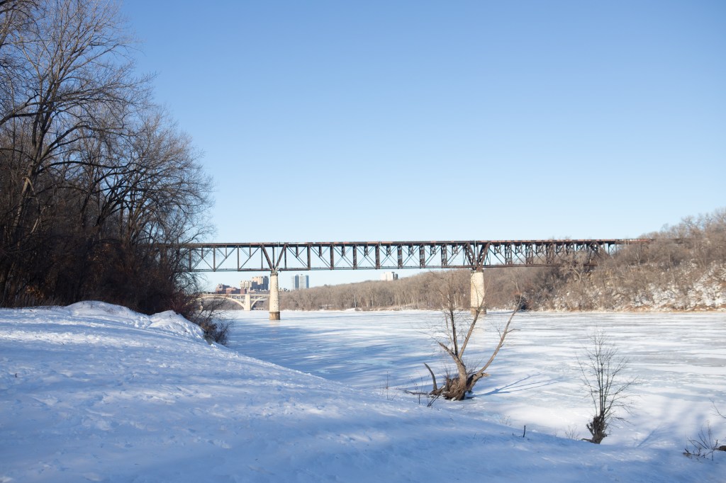
A river covered in snow with a railroad bridge in the near distance and in the far distance a few skyscrapers.
Mississippi Gorge Regional Park, Minneapolis, courtesy H. Jiahong Pan.


38th Street Trailhead
Take Route 38C or 38H to 38th Street and 46th Avenue. Walk east three blocks. Service runs every 30 minutes 7 days a week. Or, take Route 9A, 9C, or 9N to 42nd Avenue and 38th Street, stop for the Riverview Theater and Mother Earth Gardens. Walk east seven blocks, about 0.5 mile. Route 9 runs every 30 minutes on most of the weekdays, Saturdays, and Sundays during the day.


Minnesota Valley National Wildlife Refuge, Bass Ponds Trail
Hike down to the Minnesota River and enjoy the lakes.

86th Street Trailhead
Take METRO Blue, Red or D Lines, Routes 54, 442, 444, 495, 515, 540, 542, or 686 to Mall of America Transit Station. Walk 0.6 mi south on 24th Avenue, which becomes Old Shakopee Road, to 86th Street. Walk east until you see the trailhead.
Or, take Route 538 or 539 to 86th St and Old Shakopee Road. Head east on 86th Street, in the direction of the fire station. Pass the fire station until you see the trailhead.

Moir and Central Park
Hike down to a creek on a trail that ends with a sweeping, swampy view of the Minnesota River.

106th Street Trailhead
Take METRO Orange Line or Routes 465, 534, 539, or 546 to 98th Street Station (Route 465 buses refer to the station as South Bloomington Transit Center Gate B). At 98th Street station, transfer to Route 18E going south. Get off at 106th and Humboldt. From there, take the south sidewalk and walk west ~700 feet until just before the bridge. There is a trail leading down to the park below, and ultimately, the hiking trail. The Minnesota River is to the south. The Orange Line runs every 10 to 15 minutes throughout the day. Route 18E runs every 30 minutes most of the day, all week. Other buses run around once an hour. 

You may also hail a Metro Micro bus from 98th Street Station. Download the Metro Micro app and set up an account. Then, have the driver pick you up at Gate B – 98th St Station and drop you off 1826 W 106th St, AKA Nine Mile Creek Access Point. If the driver is not familiar with that area or where to drop you off, direct the driver to drop you off in a parking lot (just off 106th between Morgan Ave S and James Rd.) just across the bridge.  You may also book the ride by calling (651) 602-1170.

Minnesota Valley National Wildlife Refuge, Chaska Unit
Experience the low-lying forested areas of the Minnesota River.

Athletic Park Trailhead

  • Download the SW Prime App and create an account
  • Board either the METRO E Line or Route 515 to Southdale Transit Center.
  • Right when you get on the bus, open the SW Prime app and request a ride from Southdale Transit Center to 725 W 1st St in Chaska. Note the wait time.
  • Check the app again when you are about “wait time” away from Southdale Transit Center. For example, if the app says a bus will arrive in 20 minutes, check the app again when you are 20 minutes out. Book the ride when you are 20 minutes out.
  • Get off at Southdale Transit Center and wait for your Prime bus.
  • Board the Prime bus. Fare is $5, which can be paid by Go-To card, cash or credit card.
  • Take the bus to your destination.
  • When returning, request your ride before 6:30pm on weekdays and before 4:30pm on Saturdays.
  • If you have trouble booking your ride, call (952) SW-PRIME

Richard T. Anderson Conservation Area

Majestic views of the Minnesota River valley awaits with a steep hike on a reconstructed granite trail.

  1. Download the SW Prime App and create an account
  2. Board either the METRO E Line or Route 515 to Southdale Transit Center. 
  3. Right when you get on the bus, open the SW Prime app and request a ride from Southdale Transit Center to Richard T Anderson Conservation Area, 18700 Flying Cloud Dr in Eden Prairie. Note the wait time. Do not book the ride just yet.
  4. Check the app again when you are about “wait time” away from Southdale Transit Center. For example, if the app says a bus will arrive in 20 minutes, check the app again when you are 20 minutes out. Book the ride when you are 20 minutes out. 
  5. Get off at Southdale Transit Center and wait for your Prime bus.
  6. Board the Prime bus. Fare is $5, which can be paid by Go-To card, cash or credit card.
  7. Take the bus to your destination.
  8. When returning, request your ride before 6:30pm on weekdays and before 4:30pm on Saturdays. 
  9. If you have trouble booking your ride, call (952) SW-PRIME

Lake Maria State Park

This will require a bit more pre-planning. But it’s worth it, since it will probably be the last time you can do it. The reward? Solace and solitude as your foot steps on the snow. 

This trip involves the use of the Northstar Line (which will be discontinued come January), as well as a dial-a-ride bus. The total trip time is about 12 hours, and requires waking up early in the morning. 

Before the trip, do the following:

  1. Find a weekday to not work
  2. Call Trailblazer Transit at 1 (888) 743-3828 one week ahead of when you won’t work
  3. Tell the reservationist your name and a street address. They need this to communicate with you.
  4. Tell them you want to go from Big Lake Northstar Station to 11411 Clementa Ave NW in Silver Creek Township at 7:45 am
  5. Tell them you need to return to the station by around 4:15 pm. The Northstar train back to Minneapolis leaves at 4:40pm. You’ll want adequate time to transfer.
  6. The reservationist will then place you on hold to find your rides
  7. If the reservationist finds you a ride, they will tell you how much you need to pay. Rides can be billed.

If you have those rides scheduled, you’ll then do the following:

  1. Arrive at Target Field Station and board the 6:40am train. This is the only northbound morning train.
  2. The train arrives at Big Lake station at around 7:30am. Here, you’ll wait for Trailblazer Transit. Hungry or need to use the restroom? There is a Casey’s about a 10-minute walk north of the station.
  3. Board Trailblazer Transit, and the driver will take you to Lake Maria State Park
  4. Have the driver drop you off at the trailhead center. The trailhead center, which is open year round, is beyond the main gate, the first left off of the main road. 
  5. Once you get dropped off, enjoy the outdoors, but also step inside the center to recharge your phone, warm up, relieve yourself, and drink some water.
  6. You will be picked up at the same place where you are dropped off.
  7. The only southbound afternoon Northstar train leaves at around 4:40pm and returns to Target Field Station at around 5:30pm. 

Northstar Fare is typically $6.25 one-way on weekdays. For Trailblazer Transit, your first two rides are free. Then, rides are $4 if traveling up to 25 miles, $8 if traveling more than 25 miles. 

(Apologies for the inconsistent formatting. I have lost my patience with WordPress…)


Sign Up

Sign up to get notified when The Transit Trekker Manual: Washington State is available.

A dark brown cat sniffs a promotional pin for Trailhead Direct's Mt. Si route that is sitting on a topographic map of the Mt. Si trailhead. But her head obscures the actual trailhead.

Trailhead Direct and Hurricane Ridge Season is Almost Here

These two seasonal shuttle services start May 24, 2025

The weekend of May 24 kicks off the annual start of at least two seasonal shuttles in the Salish Sea region designed with hikers in mind. Both run through September 1.

Trailhead Direct

Trailhead Direct wooshes citydwellers from a few key light rail stops including (NEW this year) S. Bellevue Station and Eastgate Park & Ride directly to at least seven trailheads in the Issaquah Alps, Cougar, Squak and Tiger Mountain area. If you’re willing to walk short distances, it’s also easy to discover several other trailheads that this weekend & holiday service will open up to car-free hikers. Right now I’m keeping my fingers crossed that earlier routes like Mailbox Peak will finally return after a pandemic-induced driver shortage, which would open up some pretty incredible car-free backpacking opportunities.

Cost

Standard Metro fare ($2.75 ish); use an ORCA card, exact change in cash, or whatever other fare payment options Metro currently offers (there are too many to keep track of these days).

Hurricane Ridge Shuttle

The Hurricane Ridge shuttle makes my heart sing because it offers daily service, not just weekend and holiday service, showing once again that smaller cities and less-resourced counties can and are lapping Seattle and King County — hey, I love them, I live in them, but I also love to see underdogs doing things better. The shuttle runs several times a day from Port Angeles up to Hurricane Ridge, has capacity for two or three bikes (call the agency to confirm), and puts some epic hiking in Olympic National Park (ONP) into reach for car-free folks.

Pro-tip for bikepackers from the Seattle area: Take the early run of the Clallam Transit Strait Shot from the Bainbridge Ferry Terminal to Gateway Transit Center Ferry Terminal in Port Angeles. From there, hop on the Hurricane Ridge Shuttle to deliver you to your chosen trailhead.

Cost

You must purchase an entrance pass to ONP before boarding, then pay up to $1 in Clallam Transit fare. The Clallam Transit link above helpfully provides more details and links on purchasing ONP passes.

Sign Up & Support

Support Transit Trekker here. And Sign up to get notified when The Transit Trekker Manual: Washington State is available.

Header image My cat’s head obscures the Mt. Si Trailhead on my Rattlesnake Mountain region topographic map, next to which I’ve placed a Trailhead Direct pin featuring the Mt. Si route.