I mentioned I’ve been making a point of writing trip reports over at the Washington Trails Association (WTA) site. I had to run some errands in Port Townsend the other day and so had some time to check out a short beach hike. Here’s the trip report.
Pro-tip for transit trekkers planning a day trip from Seattle or Edmonds: You don’t have a ton of time if you want to make use of the Kitsap Fast Ferry–Kingston Express or Edmonds-Kingston ferry combo. Two things you can do:
1 — Help solve that schedule dilemma by letting Jefferson Transit know you’d love increased frequency – earlier or later runs – to make visits easier. Take their survey here. I checked all the boxes for more service all the time. Unrealistic at current funding levels but there’s no reason to not ask. Be sure to use the comment box at the end of the survey to say thanks, and tell them if you think you would be more likely to use the Kingston Express if there were more frequent connections and if there was at least one earlier and one later Kingston Express run so a day trip would not require being quite so conscious of time.
2 — For Seattle-based folks, you can enjoy a longer day trip by taking the Jefferson Transit route 7 to North Viking Transit Center and catching the Kitsap Transit 390 to the Bainbridge Ferry. **UPDATE: Mutual Nick S. notes that it is quicker to transfer to Kitsap Transit 301 to Bremerton, which arrives in time to catch the fast ferry back too Seattle.** Also for your consideration: is there really ever an off-season for visiting Port Townsend? I personally don’t think so, but there are some fairly reasonable lodging options in town during the official off-season to allow an overnight (or longer) visit. NB that many are in old hotels that have not been retrofit for any kind of mobility access in mind. Some of the contemporary motels near the ferry terminal should be more accessible and also have decent rates.
Another pro-tip: when the tides are low enough (and you WILL want to consult tide tables), you can extend a hike from Point Wilson all the way to McCurdy Point, about 4 or 4.5 miles west, with an option to exit the beach at North Beach County Park, where you will still have access to Fort Worden State Park trails.
Note! This post was edited a bunch of times shortly after I initially published it to clean up all kinds of little errors, clarify a few points, and add that last bit about McCurdy Point.
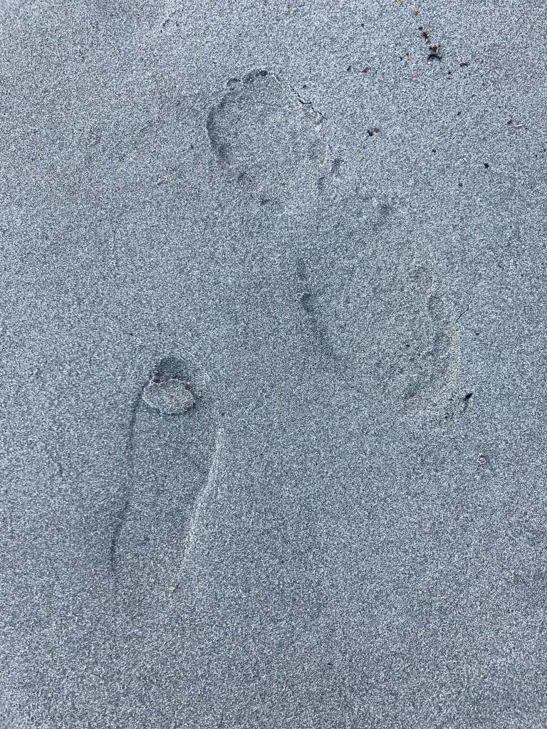
Juvenile and adult shoe prints in wet beach sand belie the recent presence of humans near Point Wilson
Off-season rates for Washington State Parks rental cabins made this last week a good one to get some away time to be with myself and focus on writing The Transit Trekker Manual. I had rescheduled from the first week in December because the weather looked iffy at the time, only for more intense weather and snow on my rescheduled arrival date to suspend the Jefferson Transit Route 1 at Quilcene. That’s about 15 miles north of the bus stop at the entrance to Dosewallips State Park. Not a walkable distance or conditions with my gear, and not something that in unpredictable winter weather I’d be comfortable bicycling, especially on a route I’d not ridden before.
No matter. Although I thought I’d looked at all possible transit permutations from Seattle to Dosewallips, as I monitored the transit agency’s severe weather service updates in hopes that this was only a one-day delay, that gave me time to look over schedules and routes again. Whereupon I discovered I’d overlooked a series of transit trips that allowed me to avoid a frigid 4-hour layover in Port Townsend, among other factors.
Yes, a few hours in Port Townsend is its own elixir under most circumstances. But I was hauling more than usual in anticipation of my week-long stay at Dosewallips, and without my bike, so flaneuring around town with both my backpacking pack and my hand-cart AKA Burley Travoy in tow, in the snow, on sidewalks that might or might not be plowed and might or might not be iced over, and might or might not have curb cuts, was not my idea of a great time. I had even plotted out my expected layover so as to explore town and stretch my legs and lungs while keeping reasonably sheltered from the elements:
The left columns list departure locations and times; the right columns list arrival locations and times. And yes, that should say 12:17 pm, not am.
In retrospect, I’m not sure why I thought I could do any hiking at Fort Worden with the trailer in the snow. I probably would not have had time anyway, given the actual state of sidewalks just around Haines Place Park & Ride transit hub — mostly uncleared, semi-frozen, slick with ice, worst at curb cuts — it would have likely taken me a full hour or more to painstakingly walk back from Water Street (and my favorite Port Townsend destination, Better Living Through Coffee) to catch the Fort Worden-bound bus. I’m still very wary of being indoors with folks for long periods of time, even masked (I plan to get my bivalent booster in the next few days) or I would have happily planted myself at the library for all those hours instead of just a little.
The Seattle-to-Dosewallips trip I ultimately pieced together added one bus segment but reduced the layover factor by three hours, letting me leave home later rather than earlier in the morning. The weather was looking slightly less intense, but I knew I would still have to wait until morning to see if Jefferson Transit was going to resume full service on the route 1.
The next morning I furiously refreshed the Jefferson Transit page for severe weather service updates. It turned out that the route 1 was still not running all the way to Triton Cove, it’s southern terminus along 101. Nor was it running to Dosewallips. But! It was running to Brinnon, the stop just before Dosewallips. I knew from my scoping out the trip that there was a pedestrian pathway along Highway 101 on the bridge over the Dosewallips River, connecting the north and south sides of the park so folks don’t need to walk on the highway. Neither the park maps nor online maps make it exactly clear how to access it from town, but it looked like less than a 10-minute walk from the bus stop to my cabin. I’d delayed my trip by a day already and I wasn’t going to let a few minutes of possibly having to walk on the shoulder of 101 stop me from enjoying my planned week of respite and work.
Once I was off the bus….well, some sections of highway 101 shoulders are more narrow than others. And with two short bridges over marshy areas, to get to the ped path it looked like I’d still have to walk on those narrow shoulders, which still had snow plow pile up the sides, before I could get close enough to the ped walkway. Thankfully traffic was light, and notably, drivers of largest vehicles, including a semi, were by far the best at slowing and giving me ample space. I made it to the main 101 bridge over the Dosewallips and its wider shoulders and thought I might just be able to walk the shoulder to the main park entrance. But then I saw up ahead the curve of the highway and narrowed shoulders cramped by guardrails on both sides, and limited sight lines around the curve. I looked across the highway at the low concrete wall lining the pedestrian path on the other side. After a moment of assessment, I decided I could lift the Burley over that low wall. And so when traffic was clear, I crossed, lifted myself over and onto the snow-encrusted walkway, and then rolled the Travoy’s wheels and body up and over. Disappointed but not surprised, unlike 101 and the roads in the park when I arrived, the pathway was not plowed. (This would prove to be an ongoing issue when I walked into town after the snow melted off, because there’s a high lip on the river side of the walkway, which slows the snowmelt considerably, creating the effect of walking through a stream.)
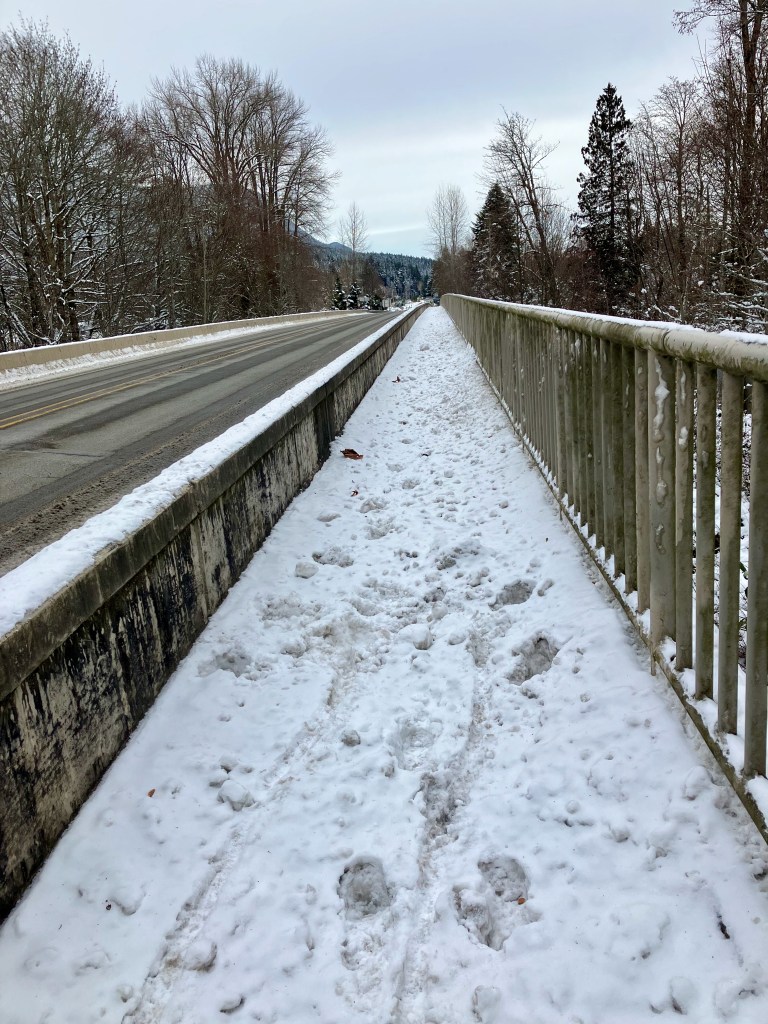
Looking north back toward Brinnon from the pedestrian walkway. I took this photo the day after I arrived but you can see the tracks from my Burley right about where I pulled it up and over from the shoulder of 101.
From here I carefully made my way down a ramp that led to an underpass connecting the east and west sides of the park, and the sector of the park where my cabin was located – right there.
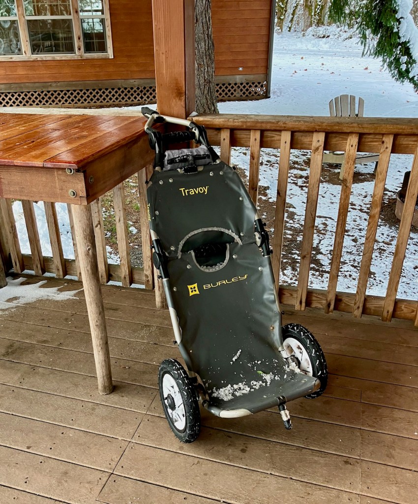
My Burley Travoy unpacked on the porch of my cabin at Dosewallips after assisting with my transit trek there. The cabins are cozy & basic; heat, lighting, electrical outlets, beds, tables, chairs. There’s room on the porch to cook — I brought backpacking food that just takes hot water, and small electric kettle. Restrooms and showers are nearby.
Later I discovered that getting to the path involves little more than crossing 101 during a lull and finding a well-worn but unsigned goat path that connects to the walkway and its ramps. (Not that accessible, alas, and neither is the park for mobility aids, though I guess that falls under YMMV.) The goat path likely would have been much more visible in the summertime, since the snow obscured a lot of cues that I otherwise would have been able to consider in my navigational choices! Better signage on the park’s and county’s part about the sidepath option would have also been useful, even in better weather. And if the goat path is on public park property or a DOT or other easement….just pave it already.
A couple of days in, I also discovered through speaking with a park staffer that the county didn’t consider Triton Cove enough of a priority to plow, which is one reason the bus likely held at Brinnon the day I arrived. I did not confirm this with Jefferson Transit….but whichever the jurisdiction, once again, disappointed but not surprised that a key transit connection — the only one between Mason and Jefferson Counties, by the way — is not considered a priority for plowing. Especially ironic to me when so much of the conversation I overheard on the buses I rode in Jefferson County was how unsafe the roads were for driving — many of the folks on my buses were riding precisely because they wanted to avoid driving but needed to get around.
These are the kind of barriers that nondrivers in these communities should not have to confront, and they are barriers that people who can drive rarely have to confront. Consider the rarity with which the state closes highway passes due to snow, and the great and repeated lengths it goes to plow those passes (and despite the near-certainty of costly collisions that end up delaying that traffic anyway and putting first responders at risk); yet a critical transit connection suffers a gap because some jurisdiction won’t plow sufficiently for bus service, which is a much safer way to travel, particularly in snow. One thing I’m working on with The Transit Trekker Manual is providing users a tool to provide feedback to All The Jurisdictions about the gaps and opportunities to improve the transportation network for nondrivers in the places they visit by transit. It would be a mistake to use the interest I think exists for transit-based recreation to only increase service and convenience for visitors without first closing the gaps and enhancing service and mobility for the communities I am encouraging folks to travel to and through.
Back to Dosewallips…
I arrived at the park at a magical time, when almost everything was covered in snow and the quiet that comes with it.
Dosewallips beach after last week’s snow. You can do this as a #TransitTrek. Crabbing. Shellfishing. Dayhikes at Dosewallips & Mt. Walker. pic.twitter.com/k1Zp19EDRl
Later in my stay, after days of heavy rain melted the snow (and flooded part of the park, forcing one of the parties in a cabin in another part of the park to relocate to the empty cabin next to me), another kind of glorious emerged, including the famous elk of Dosewallips. My own sighting and so elk photos came at a pretty far distance earlier in the day— over in the meadow on the other side of the river. David Faber (who happens to be the mayor of Port Townsend and wrote a thoughtful letter about the Week Without Driving in the city’s October 2022 City Newsletter) happened on elk up close and kindly allowed me to use his tweet here. This is along Highway 101 just south of the park’s main entrance.
There’s quite a lot you can do using the park or nearby resorts or lodging as bases, including starting some epic backpacking trips on the Olympic Peninsula. You can also walk or roll from the park to the very-nearby Geoduck Lounge (see the results of my visit below) if you don’t mind crossing 101.
Dosewallips will be a featured trip in The Transit Trekker Manual with lots more details than I can offer here. (Yup, that’s a hint to sign up to get notified when the manual is released!)