Idyllic scene of a small river bounded by trees on each side with a steel bridge in the distance and, further in the distance, mountains. It is near dusk and the sky is partly cloudy with much sun glowing through in the distance.

Transit Trek with Me to Snoqualmie Valley

This month, Snoqualmie Valley Transportation at long last launches weekend service on their Valley Shuttle route. Join me Sunday, August 18 for a celebratory outing to ride the shuttle and enjoy Tolt-MacDonald Park — or an outing of your own.

What: A Transit Trek and Informal Celebration

Later this month, Snoqualmie Valley Transportation launches much-awaited and much-needed WEEKEND service on its North Bend to Duvall Valley Shuttle line.

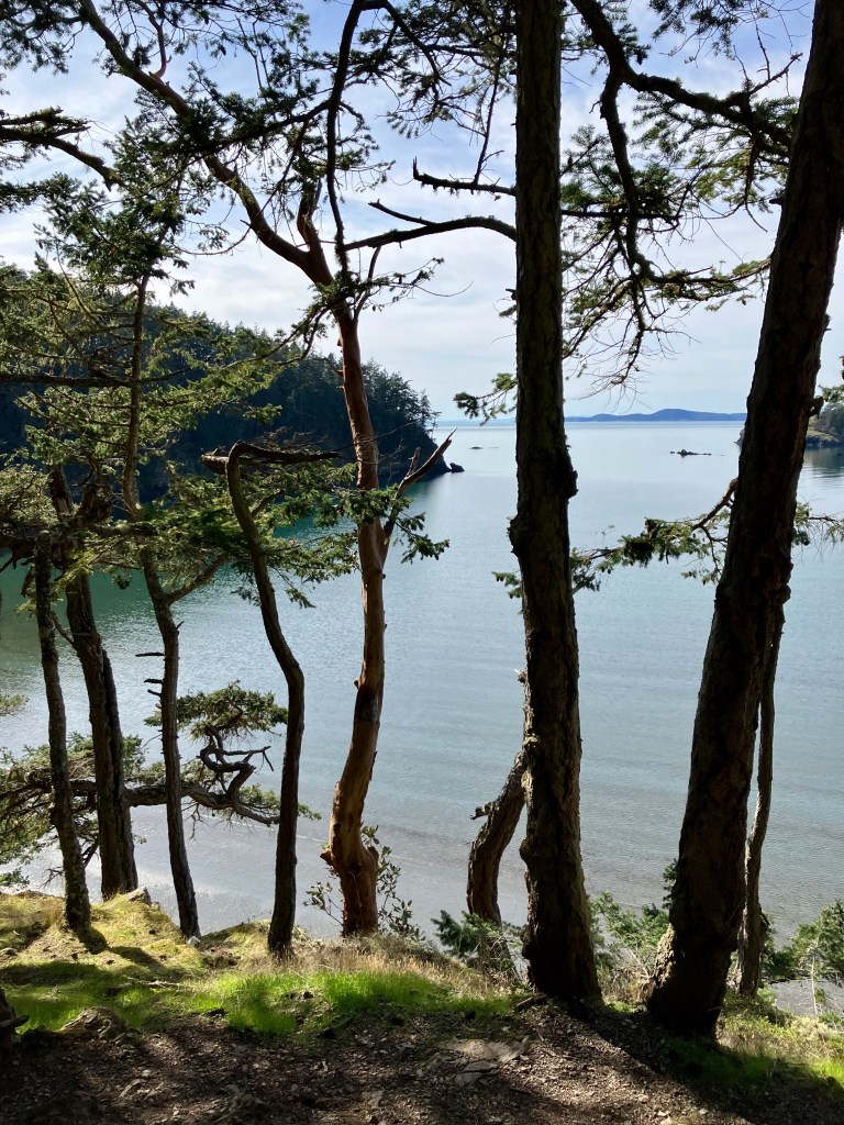
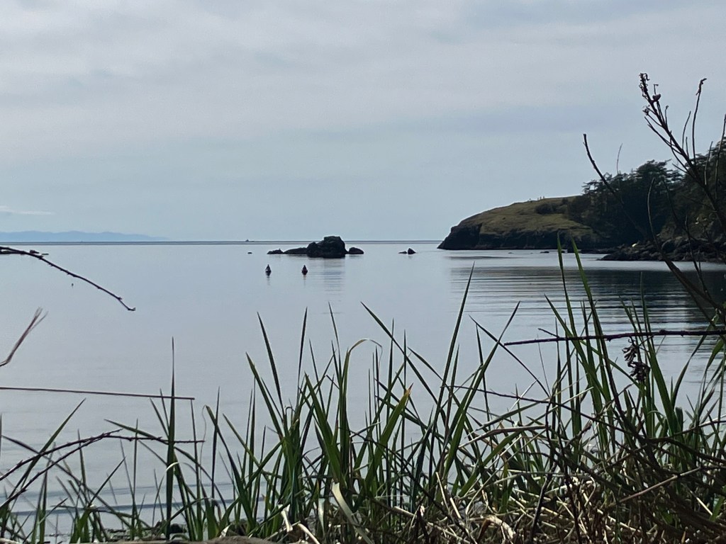
This is big news that improves mobility for everyone in the Snoqualmie Valley. And it’s a big deal for car-free access to the area, putting the jewel that is King County’s Tolt-MacDonald Park into easier reach and improving access to the Snoqualmie Valley Trail. There’s SO MUCH to enjoy in the Snoqualmie Valley. Come and celebrate with me.

Want a social outing? Join a group to explore trails in Tolt-MacDonald Park. Or Choose Your Own Adventure if you want to be part of the celebration but prefer to do your own recreational thing. Keep reading for ideas, and important details, then RSVP to join.

When: Sunday, August 18, 2024

This is an all- or most-of-the-day outing. RSVP to get the exact schedule.

Option A: Group Outing to Tolt-MacDonald Park in Carnation
  • We’ll depart Seattle from Broadway and Denny on one of the earlier runs of Trailhead Direct to North Bend Park and Ride. Feel free to hop on at later stop if that works better for you.
  • We’ll hop off at North Bend Park & Ride and mosey to a local joint for some free celebratory treats before hopping on the Valley Shuttle to Carnation and Tolt-MacDonald Park.
  • Depending on the size of the group and preferences, we’ll explore the trails in the hills above the park. Or, if folks prefer to amble along the easier river trails, that’s is an option, as is breaking into two groups.
  • We’ll plan to catch the Valley Shuttle as a group back to North Bend in the afternoon.
  • Bring your own lunch or plan to grab something in town before the return trip. We’ll leave ample time for this in the schedule.
Things to know about Carnation and Tolt-MacDonald
  • It’s about two blocks to the park from the bus stop.
  • There’s an offleash dog park at nearby Valley Memorial Park. (The park map linked below is incorrect — the old offleash area is no more.)
  • There’s a playground at the park.
  • There are restrooms and sanicans throughout the park.
  • The paths in the park nearest the river are flat, but quite gravelly. There are shorter but lovely paved paths on the east side of the park.
  • The annual Refuge Outdoor Festival will be in its final day during our visit. Please be mindful and courteous of folks there to enjoy the festival.
  • There are several food options in town and a grocery store with a deli counter.
  • More details below.
Option B: Choose Your Own Adventure

After meeting up for our informal celebration and treats, there are plenty of options for those who want to strike out on their own. The following trips can be mostly started from North Bend without transferring to the Valley Shuttle:

  • Take your pup to the expansive Three Forks Off-Leash Dog Park, which is right off the Snoqualmie Valley Trail.
  • Fishing/swimming/water sports in Three Forks Natural Area along the Snoqualmie River.
  • Take a short hike on the Snoqualmie Valley Trail, then exit at Tollgate Farm Park, a kiddo favorite from what I hear.
  • Mt. Si Golf. Golf club rentals are available; or call SV Transportation 425-888-7001  (at least a day in advance; more is better) to ask for flexible service to get dropped off and picked up closer to the entrance. UPDATE: Route deviation is a separate service launching in the coming months.
  • Hang around near the Elk Fields to see if any of the herd are around.
  • Get on/ back on Trailhead Direct to continue on to the Mt. Teneriffe, Mt. Si or Little Si trailheads.

The following trips require catching the northbound Valley Shuttle from North Bend. Destinations are listed in the order they are served by the northbound Valley Shuttle, from south to north:

  • Snoqualmie Falls — use the SE Fall City-Snoqualmie Rd & Tokul Rd stop, just after you pass under the wooden overhead walkway (which you can use to get to the falls and avoid crossing the busy highway here).
  • Remlinger Farms — Pony rides and steam train rides; U-pick raspberries — About a 20-minute walk from the Entwhistle St bus stop in Carnation, mostly via the Snoqualmie Valley Trail, or call SVT ahead of time to request a route deviation to the entrance at 425-888-7001 for both drop off and pick up. UPDATE: Route deviation is a separate service launching in the coming months. You would request a ride from a bus stop in Carnation ahead of time.
  • Camlann Medieval Village — use the Kelly Rd NE & 320th Way NE stop, or ask the driver if a flag stop is possible at the entrance to Camlann.

To return, hop on the Valley Shuttle or under your own power to return to North Bend. The westbound Trailhead Direct back to Eastgate Park & Ride and Seattle stops in front of the Pour House Bar & Grill.

How: Hiking boots on the ground and ORCA cards in hand

RSVP so I know to expect you, to get last-minute updates, and so I can order about the right amount of celebratory treats.

Who: You

Info to help you decide if this is a trip you feel comfortable joining. All apply to the Tolt-MacDonald outing but some apply to any destination:

  • Attending is free, as are celebratory treats, but participants are responsible for their own transit fare, lunch, and so on. Please note when RSVPing if you need assistance with fare; I’ll see what I can do.
  • I suggest that folks wear masks when riding the bus.
  • We’ll go rain or shine, but extreme weather may cancel or alter our plans.
  • Hiking mileage: as little as you want, up to 12 miles of trails in Tolt-MacDonald Park.
  • Restrooms access: there are portapotties throughout the park and flush toilets in the RV section.
  • Water: Access at the RV restroom and spigots just west of the suspension bridge
  • Kiddos are welcome, and Tolt-MacDonald Park has a playground. Trail elevation is variable, with the option to stick to easy riverside trails or to hike up into the hills west of the camping area.
  • Dogs: Welcome, but please see both Metro and Snoqualmie Valley Transportation’s guidelines (see the Service Animals/Pets tab) about bringing dogs on board, and if you aren’t joining the hike, be sure you know if dogs are welcome at your destination. (Metro doesn’t make it easy to find this on their site these days, so, sorry, no link.)
  • Service dogs are always permitted on transit.
  • Some paths on the east side of Tolt-MacDonald are paved and more or less flat, and thus wheelchair friendly. The flat, gravel trails along the Tolt River in that section of the park are much less so, as are the flat trails on the west bank of the Snoqualmie River
  • For deaf or hard of hearing participants, please note your access needs in the RSVP form. While I don’t have the budget to hire an interpreter, I will do my best to work with you to find a good alternative. 
What to Bring
  • ORCA card or cash for Trailhead Direct fare, plus $2 for the suggested cash donation for the Valley Shuttle ($1 each way)
  • Dress for weather. We’ll go rain or shine, but extreme weather may cancel or alter our plans. 
  • A mask for our bus rides
  • Sunglasses, sunscreen, and other sun protection you need
  • Snacks and water
  • A sack lunch if you don’t want to grab lunch in Carnation or if needed for your chosen outing
  • Any permits (like for fishing) or other necessities for your chosen outing
Handy Links

Header photo of the Snoqualmie River looking south, taken circa fall 2020 or 2021 from the suspension bridge at Tolt MacDonald Park.

Deception Pass Update — Easy with Amtrak

View looking out across Coronet Bay at Deception Pass State Park at low tide, so you can see muddy flats along the shore. In the near distance are a couple of sail boats, in the mid distance, a forested bit of land jutting out, and in the far distance a snow-capped mountain. I think that is Mt. Baker but I am not sure.
Coronet Bay at low tide, Deception Pass State Park, March 2023

I needed a quick reset so took a short trip up to Deception Pass State Park last week, getting in the last of off-season cabin rates. (Some people are forever young; I am forever thrifty.)

With the return of Amtrak Cascade’s full schedule, this is probably one of the best (longish) day or multi-day transit treks you can do in western Washington. It’s a fairly quick trip if you use Amtrak, or are based in Bellingham or Everett. Deception Pass is a large park with many miles of trails both beach and forest, some of which allow bicycles. Nearby, mostly quiet back roads of north Whidbey Island offer more bicycling. Swimming in Cranberry Lake. Crabbing and fishing (in season). Kayak rentals. I’m sure I’m forgetting some. Not up for tent camping? Rent a simple cabin, with nearby access to showers and restrooms.

On my first visit, in March of 2021, I took two days to bicycle to the park, via the Bainbridge Ferry, the Kitsap Peninsula, and the Coupeville Ferry, then via Whidbey’s back roads. Peak-pandemic Amtrak schedules were either non-existent or I didn’t want to be indoors for hours at the time, masked or not, so my itinerary minimized transit, planning just a couple of short bus rides for the return trip.

Amtrak Cascades reverted to its full pre-pandemic schedule in early March, which made this trip a lot quicker and easier than my earlier trip.

A view of my two bags sitting on the sidewalk. One is a medium sized suitcase that can be worn as a backpack and the other is a shoulder bag.
My stuff. I brought too many clothes.

TIME

The trip from King Street Station to Deception Pass is about 2.5 hours. That includes a 30-minute layover at Skagit Station, just enough time for a quick trip to the Skagit Food Coop a few blocks away in downtown Mt. Vernon. If you opt to chill in the station, it has all the basics: restroom, water fountain, and some seating (but no longer has a coffee shop).

BUS BASICS

It is possible to do this trip via public transit in a bunch of different ways (details on a couple of those below). But this Amtrak-based itinerary cuts out at least 2 transfers for those starting south of Everett. You can do these trips Monday-Saturday, though Saturday schedules are more limited — you’ll want to plan your return accordingly if you are doing a day trip, or plan to stay over through Sunday if you are weekending. (UPDATE 7/2/23: Island Transit recently started running some Sunday service from Oak Harbor to Deception Pass, making trips between Mukilteo ferry-Clinton-Oak Harbor-Deception Pass possible on Sundays.)

From Seattle or points south via Amtrak

  • Amtrak Cascades to Mt. Vernon/Skagit Station. Roundtrip fare ~$30 & up, ~90-minute ride from Seattle; some runs are via buses, which are comfy and have bathrooms on board
  • 30 minute layover at Skagit Station
  • Skagit Transit 40X to March’s Point. $1 each way; leaves at 15 after on the hour; ~ 25-minute ride and little to no layover. Don’t panic that the 40X is scheduled to arrive at the same time the 411W is scheduled to depart, because the 40X typically arrives a few minutes prior than its scheduled arrival time unless there is major traffic disruption. If you’re concerned, ask the driver about it. If in the unlikely event you miss the connection, there’s a coffee shop across the street at March’s Point where you can wait for the next 411W, which runs hourly. Or, if you brought a bike, you have an hour to ride up to the Tommy Thompson Trail and enjoy the ride across Fidalgo Bay and back.
  • Island Transit 411W to Deception Pass State Park/Coronet Bay Road; Fare-free, ~ 10-minute ride. This is the first stop after the bus crosses the bridges over Pass Island between Fidalgo Island and Whidbey Island, and is just after the stoplight at Coronet Bay Rd, the main park entrance. Island Transit does not make any stops near the Fidalgo side of the park or the pass (you can walk and hike or bike from the Whidbey side, though).

From Bellingham or Everett

Amtrak won’t save you much time if you’re coming from Bellingham or Everett. County connectors are good options unless you prefer the more cush ride on Amtrak.

  • From Bellingham Station, take the connector route 80X to Skagit Station, then catch the connections as described above. This bus is operated jointly by Skagit Transit and Whatcom Transit Authority, so look for the route number, not the transit agency “livery.” $2, 45-minute ride
  • From Everett Station, take the county connector route 90X to Skagit Station, then catch the connections to Deception Pass as described above. $2, 35-minute ride

If Amtrak feels pricey or you don’t mind a longer journey, below are some fairly direct transit options from Seattle to Mt Vernon/Skagit Station that are considerably cheaper.

From south Seattle, anywhere along the Link 1 line, or UW

From Downtown Seattle and points north without good access to Link

  • King County Metro RapidRide E to Aurora Village Transit Center, then Community Transit SWIFT Blue line to Everett Station, then county connector route 90X to Skagit Station, then catch the connections as described above

Again, this is not an exhaustive list, but these are among the most direct options from the Bellingham, Everett, and Seattle areas.

A view down onto the water of part of Deception Pass, through a few skinny tree trunks along a hiking trail.
A scene from a hike to the Fidalgo side of the park.

COST

My Amtrak (bus) fare was $30 roundtrip from Seattle booked the day before I left, leaving the total roundtrip fare around $35. The 7-minute walk in the rain to catch the route 12 home on my return trip would have been fine had I not overpacked, so I splurged and caught a yellow cab from King Street Station to Capitol Hill, which with a tip came to $13.92.

Train fares often cost more, but vary. (Frustratingly, the Amtrak bus runs skip Edmonds, Mukilteo, and Stanwood, all good hubs to connect to other outdoor adventures.)

NB! Skagit, and Whatcom don’t use ORCA so either bring small bills or download their fare payment apps.

BICYCLES!

If you want your bicycle with you at Deception Pass — there are some nice back roads near the Whidbey side of the park, and if you don’t mind riding SR 20 for short sections, a bike comes in handy if you don’t want to hike to the Fidalgo side — Amtrak Cascades buses do allow two standard-size bikes to be put in the luggage compartment. You must book that space when you book your ticket. Cascades trains have 10 spaces for standard-size bikes; you also must book ahead. $5 each way per bicycle (bus or train).

For a long time the question of whether bikes needed to be boxed to be stowed in the bus luggage hold was unclear, but as of this writing, I finally feel confident saying that on Amtrak Cascades bus runs, there is no need to box your bike. Folding bikes like Bromptons that meet size requirements (max 34x15x48) can be carried on as part of Amtrak’s baggage allowance and should not require a separate reservation or fee. (I have done this on trains, but not buses, but I would feel comfortable putting the Brompton in the bus’s luggage hold.)

Cyclists could plot a route from Mt Vernon to Deception Pass that takes you through Skagit County farmland, or find someone’s Ride with GPS route to follow, so long as you don’t mind some sections of SR 20 where shoulders narrow. Riding the more direct highway routes from Mt Vernon is not IMHO that great (speaking not from experience but from scouting this as a possible outing). If you can get to Edmonds, a great bike option is to take the ferry to Clinton and ride back roads to Oak Harbor before putting your bike on the bus to Deception Pass on the 411W, or to take the Island Transit 1N from Clinton to Oak Harbor and take back roads to the park. Assuming you’re not up for the near-century ride all the way to the park.

Regrettably, at this time there aren’t any good transit options for non-standard assistive cycles and other non-standard bicycle sizes.

A view out over Bowman Bay at Deception Pass, through some shoreline grass at the water's edge. There is a large rocky outcrop in the water and in front of that, two barely discernable kayakers on the water.
Bowman Bay at Deception Pass State Park, March 2023. Two kayakers on the water in the distance.

ACCOMODATIONS

There are hiker/biker sites between the Lower Loop and Forest Loops campgrounds, although they tend to be hard to find and don’t offer any prime real estate. Call ahead in the winter, though, because the Quarry Pond campground is the only one open in the off-season, and there are no hiker/biker sites listed on the map. (I think I confirmed verbally back in 2021 that they are available? Best to call ahead.) The most important thing to note about hiker/biker sites is that they do not require a reservation — these sites are first-come, first-served, and, according to a ranger/staff I spoke with in 2021, these sites rarely fill up, even in peak season. They are typically priced lower than standard campsites, too.

If you want a more scenic campsite in the peak season, you can book standard campsites in advance, or book one of the cabins at Quarry Pond. A private resort catering mostly to RVs (and does not allow tents at all) North Whidbey RV Park does have two rental cabins that sleep 4 persons each, with kitchens and full baths. It’s adjacent to the main park entrance near the Quarry Pond campground.

OTHER NOTES

— This is a popular park in peak season (and somewhat in the off season). If you prefer not to use a hiker/biker site, you’ll want to reserve well in advance.

— As noted above, the 411W between March’s Point and the main park entrance at Coronet Bay Road doesn’t make any stops, including flag stops, on the Fidalgo side of the park. You can hike or bike from the Whidbey side. A couple of the hiking trails allow hikers to avoid crossing or walking along SR20 to reach the bridges to the Fidalgo side. However, you’ll need to navigate the narrow bridge walkway as well as short sections along the SR-20 where day trippers park to gawk briefly at the pass. It can get crowded and can require walking through or around the parked cars uncomfortably close to SR-20 traffic. If there are better options, they are not obvious. The only option for cycling to the Fidalgo side is to use SR20, which has zero shoulder along the bridge and requires a left turn onto Rosario Rd. on a section of the highway that has limited visibility.

— Ask for the printed park map at the ranger station park administration office (on SR-20 and reachable on foot via the Quarry Pond campground) it’s super helpful. Usually there are a few in the brochure case outside.

— A small convenience store with gas station is located within walking distance of the Quarry Pond camping area. (This is also the closest place to catch the 411W northbound back to March’s Point).

— If you’re doing a longer stay and need to stock up, the 411W will take you to the many services in Oak Harbor, including two larger grocery stores. Catch this at the same stop you got off at, the main intersection at the park entrance.

— During winter, only the Quarry Pond campground is open.

— There are some seasonal concessions in the park, a coffee stand being perhaps the most important.

— Seasonal canoe, kayak, and standup paddle boarding rentals are available.

— You’ll likely hear and/or see noise from the jets flying out of nearby Whidbey Naval Air Station. During my 2021 visit, these were incredibly loud and fast. This time around, whatever exercises they were up to were markedly less loud.

— The park’s website says there is a mile or two of ADA-standard trails; I believe this is between the Sound and Cranberry Lake. The trails I’ve hiked in the park, other than this one, don’t appear to be above-average accessible in any respect.

— I find the check-in instructions at Quarry Pond confusing. You might call ahead to confirm exactly where to check in. In my case, I was staying at a reserved cabin, and was able to go straight there. But I would have been confused by what to do when camping.

This post was edited to tidy some errors and add information about walking and biking between the Whidbey and Fidalgo sections of the park.