Move Redmond advocates for multimodal transportation in Redmond. As part of their Ride Transit Month coverage, I talked to them about Transit Trekker. I also provided a few tips on easy transit trips that can be done from Redmond. You can read all about it in their June newsletter, here. Especially note the clear, friendly graphic treatments they created to highlight the trip itineraries I offered.
Redmond and the eastside in general could use much better local transit service, IMO. That said — Redmond has great access to multi-use trails in the form of the Sammamish River Trail, the soon-to-be re-opened East Lake Sammamish Trail, the developing Eastrail network, and — with a lift from King County Metro route 224 to Duvall — the Snoqualmie Valley Trail, which will connect you to the Palouse to Cascades Trail. That last one you can ride all the way to the WA-ID border from about May to October — hundreds of miles taking in the Cascades, eastern WA semi-desert, and the Palouse. As I write that, I am amazed and grateful all over again to live in a region rich with stunning rail trails. My e-bike is in the shop awaiting repairs (and an e$timate) and I think I’m going to be planning a quick venture along the Palouse to Cascades Trail via the eastside very soon……
The featured image in this post is used with permission of Move Redmond.
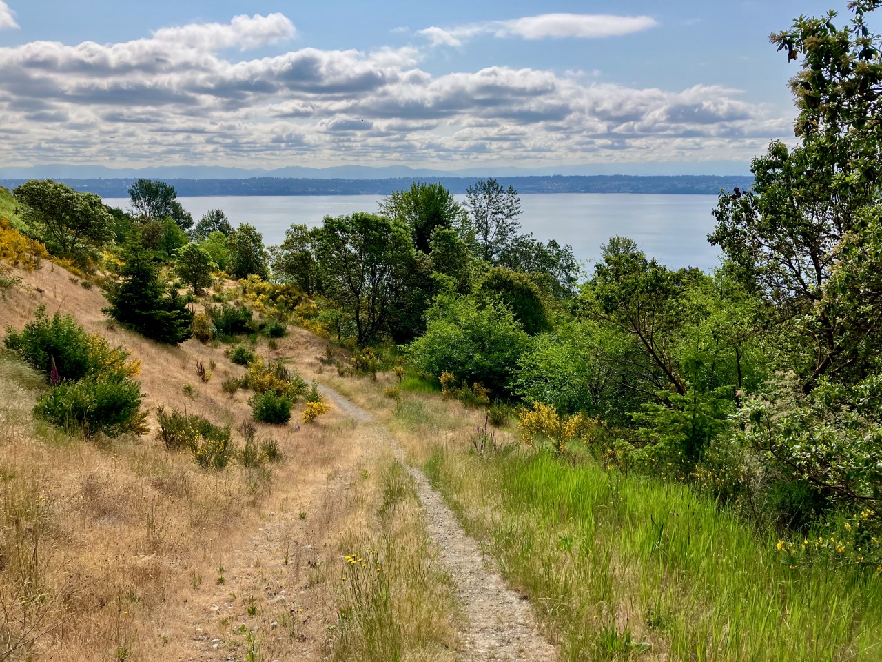
Vashon Island and Maury Island are both in King County but I’ve easily spent much more time on Whidbey and Camano islands, two counties away. That is about to change thanks to a Twittering Device mutual whose recent bike-packing trip piqued my curiosity about camping options I didn’t know existed.
Limited transit schedules meant I’d long postponed scouting a day trip to Dockton Forest and Maury Island Natural Area — those schedules requiring a long day trip or doing a multimodal trip that includes a long bike ride. Now that I followed in aforementioned Tweeter mutual Jawwwwwwsh’s footsteps with a mid-week trip of my own, I can say that I think a long day trip is absolutely worth it.
And I can also say that camping at Maury Island Marine Park (MIMP) is a new favorite outing and absolutely worth it. During my mid-week trip, I often had the entire beach to myself, and often had the entire park to myself — at least it felt like it.
As to be expected, weekend slots tend to book up. I can’t speak from experience but I’d bet that despite relative weekend popularity, MIMP still offers a good deal of relative peace and solitude, for two reasons. First, there are only seven campsites (including a marine campsite that is part of the Cascadia Marine Trail), placing a simple limit on the maximum number of folks you’ll be camping near. (Although most of the camp sites are close together, the park itself has plenty of room, elbow and otherwise.) Second, you must hike or bike (or paddle) in, and the elevation gain on the return to the park entrances is more hike in the park than walk in the park, limiting both day and overnight visitors. (And….heads up, transit trekking to here on a weekend is best done with a bicycle or booking to arrive on a Friday afternoon and depart on a Monday morning if your schedule allows, because….yup, transit schedules on these islands are not great.)
This bright, illustrated map welcomes visitors to Perico Preserve
In January I visited Florida for family matters and managed to slip away from the confines of the subdivision for a couple of local transit hikes.
Manatee County Area Transit (MCAT) stops at three preserves on its way to Anna Maria Island — Neal, Perico, and Robinson. I aimed for Robinson. (Note the pdf does not say but the main MCAT site notes service is Monday-Saturday.)
On my first trip I got off the bus at the Manatee Ave W at Perico Way stop, which looked to be a short walk backtracking east to the path leading to the preserve entrance.
En route to Robinson I discovered Perico Preserve, which shares an entry point on Manatee Ave W with Robinson. The Perico entrance at first gives an unremarkable impression, with a trail running alongside both the bayou but also the regrettable SFH development across the bayou. I didn’t expect much, and meant to take only a short detour onto what I assumed was just a single, short loop trail.
I was surprised and mesmerized pretty quickly, and ended up spending my midday at Perico. The first time it occurred to me to look up into tree tops, I saw an osprey chowing down on a fish in on a low tree branch not too far from me.
WordPress is a silly service and won’t let me upload a video onto my own site that I already pay for without upgrading so I give you here the Pericio Bayou osprey pic.twitter.com/NQ1sirEGkR
Perico can’t have more three miles of trails. Yet I easily found myself wandering for a couple of hours through this tranquil preserve’s varied ecosystems, from desert-like to more typical (to me) Florida tropical forest (and the SFH development quickly recedes from view).
Desert feels somewhere in Perico Preserve.
Bicycles are allowed in many parts of Perico (and Robinson), and most areas where they are not are gated off with clear signage, and, thankfully and thoughtfully, with bike racks adjacent the gates. Generally I found both people walking and rolling to be communicative and considerate of sharing the space, with the vast majority of cyclists riding slowly and giving others lots of space when passing. (I’m uncertain about Neal, since I did not visit.) Kid-friendly, for sure, though Robinson seemed more popular for little kids.
View from a bird blind in Perico Preserve
This is Florida, so these preserve trails are quite flat (certainly by my Pacific Northwest standards). Some surfaces are paved — Robinson in particular has some long paved pathways. Those remaining unpaved are mostly hard-packed enough that I think any mobility aid that can handle intermittent gravel and small debris could work here. The portapotty on the other side of the Manatee Ave W (see below) is large-ish but I can’t confirm if it would work well for a wheelchair user.
I found a portapotty at a Perico trailhead (a parking lot west of the bus stop at Perico Way) that was literally full of shit, up to the top of the toilet seat. You can walk under Manatee Ave W at the bridge over the bayou via a bike/walk path to another parking lot with portapotty that on my visit was in much better condition. There are also several bathrooms at nearby Robinson Preserve, though they are a bit of a trek.
This path under the arterial is also the path you’ll want to take to cross the arterial to catch the bus back toward Bradenton.
No dogs allowed here; I assume because it’s a small, sensitive area that is still being rehabilitated and to minimize potential threats to wildlife.
Tl;dr — MCAT Route 3 from Downtown Bradenton (and from points east mostly along Manatee Ave) will take you to three fantastic and pretty damn accessible day hikes at three reserves. I recommend a full, long day to fully explore Robinson, arriving early, and at least a half day each at Perico and Neal Preserves (though note I wasn’t able to scout Neal personally). If you remain on the 3, you can enjoy Anna Maria Island, which looks like it could be a pretty sweet car-free destination.
Some other notes: I remain confused as to the difference between the seasonal (always free? 7 days a week?) MCAT beach shuttle and route 3. My Saturday visit to Perico required a transfer in a strip mall parking lot (easy, because traveling both coming and going the transfer bus was waiting and departed immediately after passengers boarded). When I visited Robinson using the same route and bus stop on a weekday, the bus I boarded at the downtown Bradenton transit hub was outfitted as a trolley and traveled to the beach without requiring that parking lot transfer. The route 3 does not operate on Sundays, but the beach shuttle might? I’d clarify with the driver because MCAT doesn’t make it very clear.
MCAT has some things Seattle area transit does not always have, like public restrooms at the downtown transit hub in Bradenton. In late 2022 it started an 18-month fare-free pilot. Buses have onboard electronic signage with audio that in theory announces next stops clearly both visually and with audio. However, some fundamental communications failures marred my initial good impressions as well as costing me quite a bit of time, including zero posted info about schedule reductions related to the operator shortage. Signal timing at downtown crosswalks required long waits to cross the street, and the two main E-W one-way streets are effectively highways. Outside the immediate downtown. area near the transit center, signalized crossings thin out quickly, requiring long walks. One downtown highlight: Kefi Streetside Cafe, just around the corner from the downtown Bradenton transit center. It has ample outdoor seating, pipes through cool and not-too-loud music, and is well-buffered from the adjacent parking lot.
More on Robinson Preserve in another post; there are some great things going on there for car-free recreators.